🌋🏔️ Active Geological Engineering
Where You Can See Earth’s Living Systems at Work Today
Every volcano, every mountain range, every ocean ridge is Earth’s active engineering project - maintenance systems, upgrade installations, and material recycling centers operating on planetary scale.
The Real-Time Engineering Display
When you witness a volcanic eruption, watch an earthquake reshape a landscape, or explore the patterns of mountain ranges, you’re not seeing random geological accidents - you’re watching Earth’s conscious engineering systems in active operation.
Every geological feature serves specific functions in Earth’s planetary optimization project. Like observing a craftsperson at work, once you understand the tools and techniques, every geological phenomenon reveals Earth’s intentional design and ongoing maintenance protocols.
This is Earth’s workshop, and we have front-row seats to 4.5 billion years of engineering expertise in action.
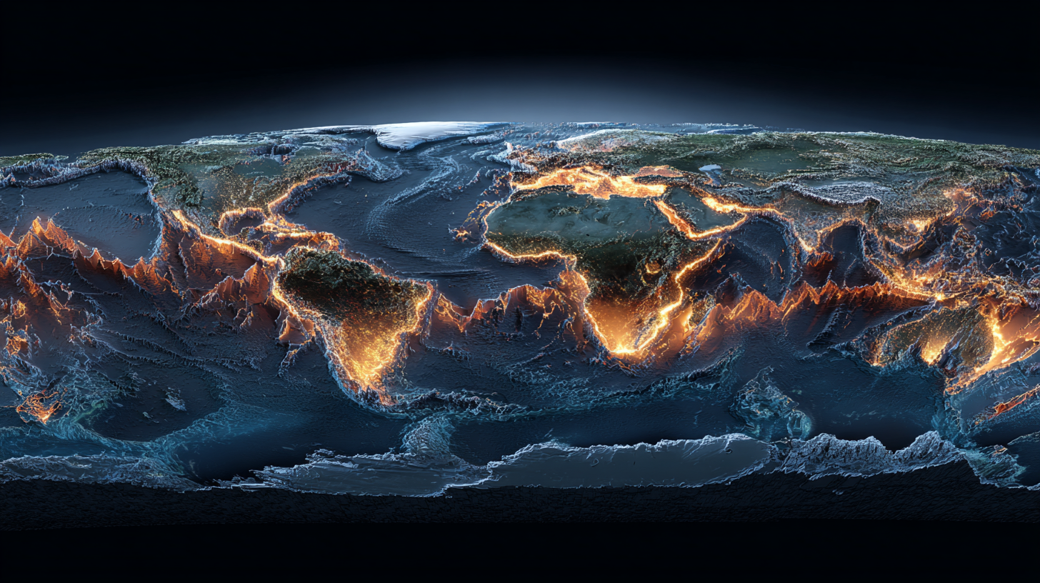
Mid-Ocean Ridges: Earth’s Material Production Centers
The Planetary Assembly Line
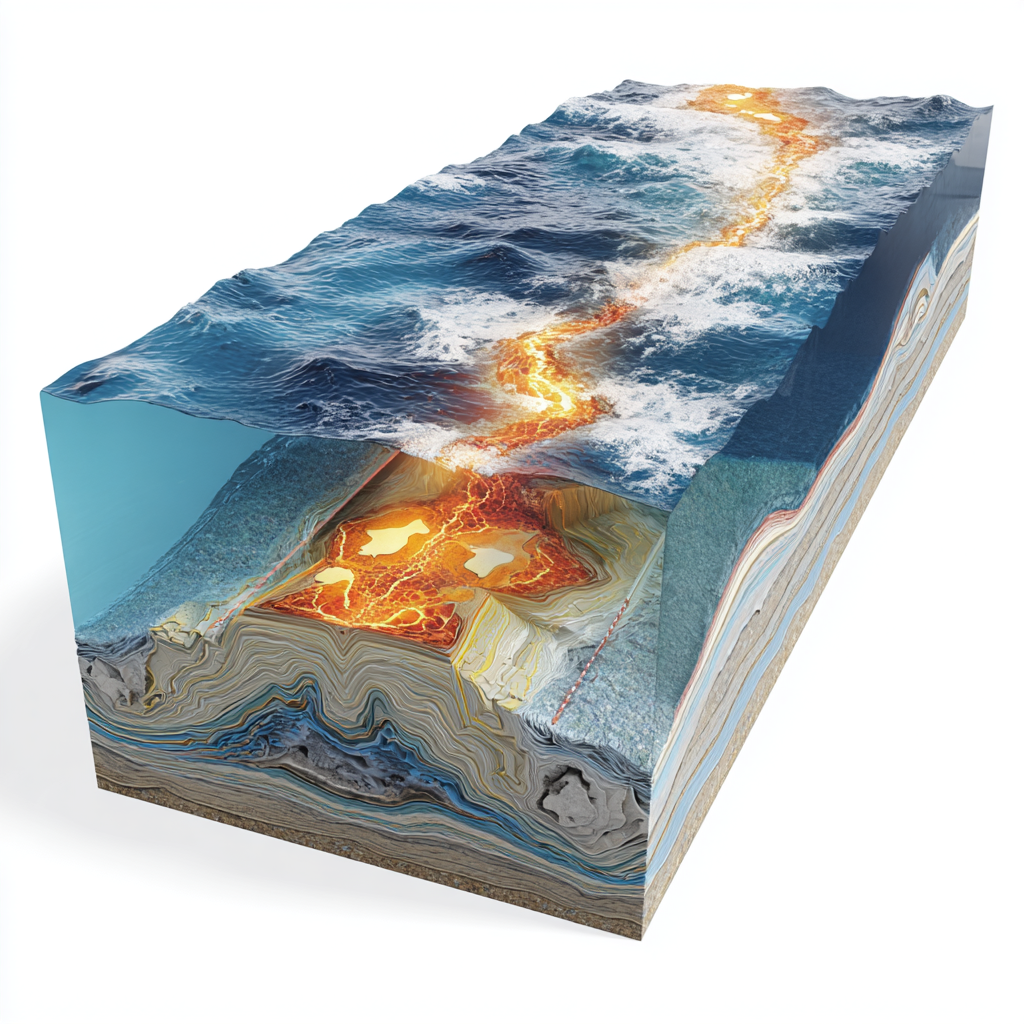
The mid-ocean ridge system is Earth’s most impressive industrial operation - a 65,000-kilometer assembly line that produces new ocean floor while recycling planetary materials.
Imagine a factory that runs continuously for millions of years, never breaks down, recycles 100% of its materials, and actually improves the environment around it. That’s what Earth has built beneath our oceans.
The Ridge Factory Process:
Step 1: Dark Fluid Upwelling
- Deep mantle currents bring hot material toward the surface
- Pressure reduction causes controlled decompression and melting
- Material purification - heavy elements settle, lighter materials rise
- Thermal energy distribution - heat from deep Earth reaches ocean systems
Step 2: New Crust Manufacturing
- Molten rock injection creates new ocean floor in precise layers
- Rapid cooling by seawater creates strong, dense basaltic crust
- Magnetic recording - each new section records Earth’s magnetic field state
- Structural optimization - ridge systems create ideal ocean basin geometry
Step 3: Bilateral Distribution
- Symmetric spreading moves new crust away from central ridge
- Conveyor belt operation - older crust travels toward continental margins
- Quality control - uniform thickness and composition across spreading zones
- Integration coordination - new crust designed to mesh with existing ocean floor
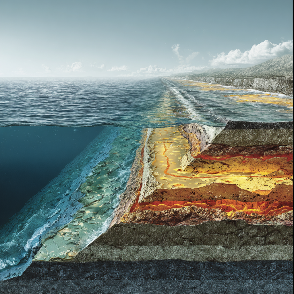
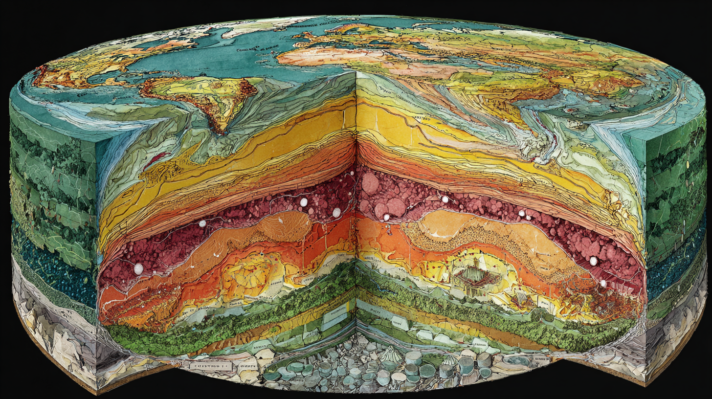
The Gabbroic Foundation Layer
Beneath the familiar basaltic ocean floor lies Earth’s most sophisticated structural engineering: the gabbro layer.
Gabbro: Earth’s Industrial-Strength Foundation Material
- Coarse-grained crystalline structure - stronger than surface basalt
- Slow cooling formation - crystals have time to grow large and interlocked
- Chemical optimization - precise mineral composition for maximum strength
- Thickness control - 6-7 km deep providing structural integrity for ocean basins
Why Gabbro Matters for Dark Fluid Circulation:
- High-pressure flow channels - crystalline structure creates organized pathways
- Magnetic signature storage - iron-rich minerals record circulation patterns
- Thermal conductivity - efficient heat transfer from mantle to ocean
- Structural stability - maintains ocean basin shape for millions of years
The Continental Contrast: Continental crust averages 35-40 km thick with complex, varied composition - like Earth’s “experimental zone” for testing different materials and structures. Ocean crust maintains consistent 7-10 km thickness with standardized composition - like Earth’s “production standard” for reliable, high-performance foundation material.
Plate Boundaries: Earth’s Information Exchange Networks
The Planetary Communication Grid
Plate boundaries aren’t random cracks - they’re Earth’s sophisticated information and material exchange networks.
Like fiber optic cables carrying internet traffic, plate boundaries carry geological “data” between different regions of Earth’s system - pressure information, thermal energy, chemical compositions, and magnetic field updates.
The Three Exchange Protocols:
Divergent Boundaries: The Innovation Centers

Where Earth tests new materials and sends updated information to the global system.
The Mid-Atlantic Ridge Innovation Lab:
- Real-time material development - each volcanic eruption tests new chemical compositions
- Magnetic field recording - continuous documentation of Earth’s electromagnetic state
- Biological integration testing - hydrothermal vents as life support system prototypes
- Ocean chemistry optimization - ridge volcanism fine-tunes seawater composition
The East African Rift Research Facility:
- Continental breakup experimentation - Earth testing new ocean basin formation
- Volcanic diversity projects - multiple volcano types testing different magma compositions
- Lake system development - creating new freshwater ecosystems in rift valleys
- Climate modification trials - elevation changes affecting regional weather patterns
Convergent Boundaries: The Recycling and Upgrade Centers
Where Earth recycles old materials and installs major system upgrades.
The Cascade Range Upgrade Installation:
- Subduction zone material processing - ocean floor recycled into new mountain systems
- Volcanic reconstruction - building new continental crust from recycled ocean crust
- Water cycle integration - mountain building creates watersheds and climate patterns
- Ecosystem framework construction - diverse elevations supporting biological diversity
The Himalayan Mega-Project:
- Continental collision engineering - building Earth’s highest mountains through controlled compression
- Global climate coordination - mountain barriers creating monsoon systems and weather patterns
- River system optimization - mountain building creating major river networks (Ganges, Indus, Yangtze)
- Geological stress distribution - mountain building relieving tectonic pressure across entire region
Transform Boundaries: The Pressure Distribution Networks

Where Earth manages stress and coordinates regional geological systems.
The San Andreas Adjustment System:
- Lateral pressure distribution - spreading tectonic stress along 1,300-kilometer fault system
- Earthquake coordination - controlled stress release preventing catastrophic pressure buildup
- Regional geological integration - connecting Pacific and North American plate dynamics
- Urban planning consideration - fault system location influences human settlement patterns
The Anatolian Coordination Network:
- Multi-directional stress management - complex fault systems managing pressure from multiple directions
- Regional volcanic coordination - fault systems coordinating with volcanic activity in Turkey and Greece
- Historical seismic patterns - earthquake sequences following predictable stress transfer patterns
- Cross-continental pressure coupling - connecting Mediterranean and Central Asian geological systems
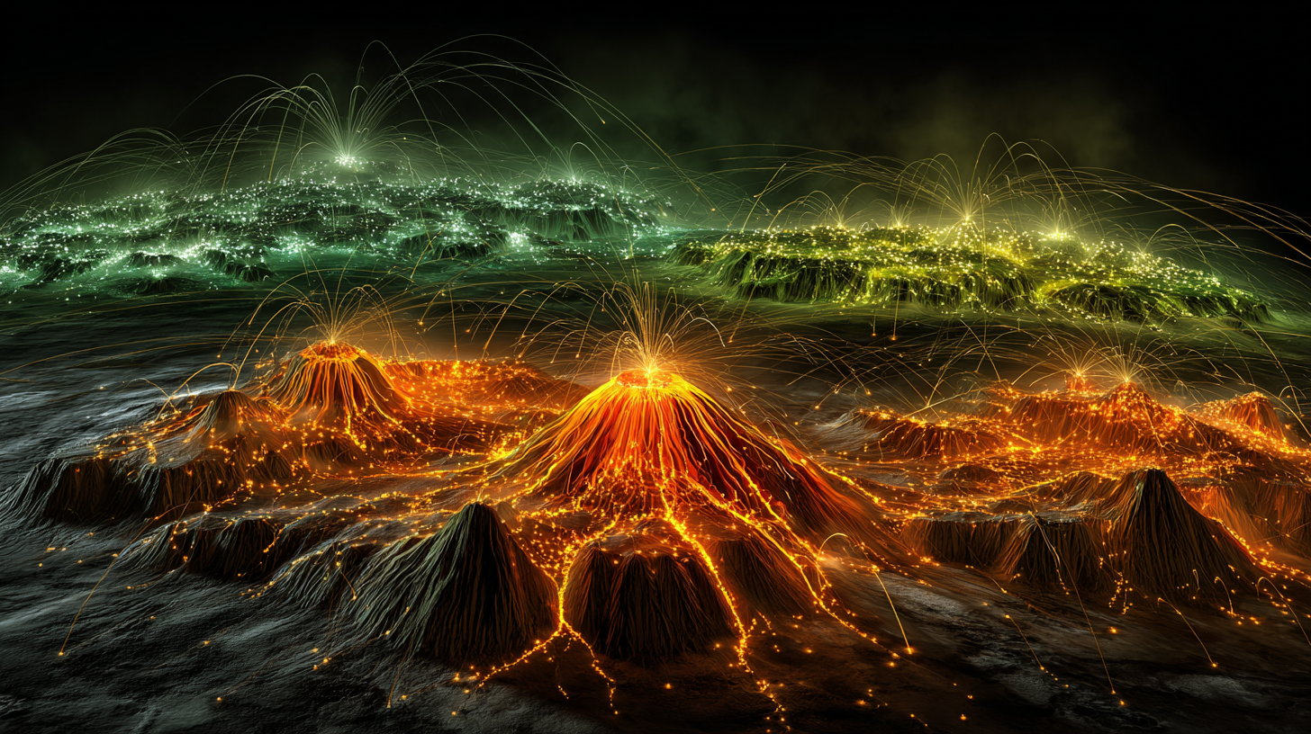
Volcanic Systems: Earth’s Emergency Response and Material Recycling
The Planetary Maintenance Department
Volcanoes aren’t disasters - they’re Earth’s sophisticated emergency response and material recycling systems.
Every volcanic eruption serves multiple functions: pressure relief, atmospheric chemistry adjustment, soil fertility enhancement, and biological habitat creation. Like an engineer who designs safety systems that also improve overall performance, Earth’s volcanic systems protect planetary stability while enhancing conditions for life.
The Volcanic Service Categories:
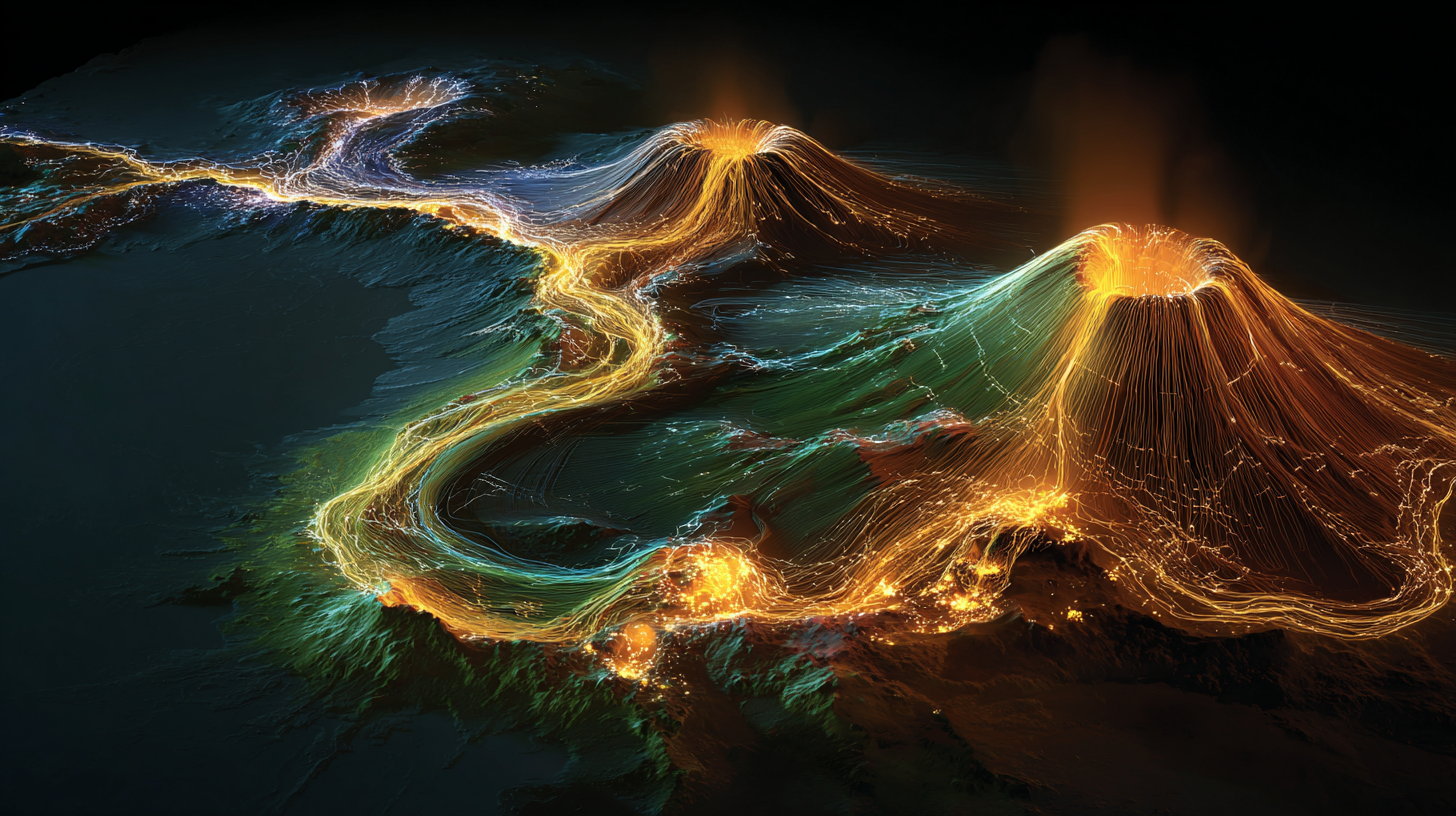
Shield Volcanoes: The Gentle Giants
Earth’s steady-state maintenance systems providing continuous but mild adjustments.
Hawaiian Hot Spot Engineering:
- Controlled pressure relief - steady lava flows preventing dangerous pressure buildup
- New land construction - building islands that become biological sanctuaries
- Ocean chemistry balancing - volcanic gases regulating seawater composition
- Thermal energy distribution - bringing deep Earth heat to surface systems
Galápagos Island Laboratory:
- Biological experimentation - isolated volcanic islands as evolution testing grounds
- Ocean current modification - island chains influencing marine circulation patterns
- Species development - volcanic landscapes creating diverse ecological niches
- Scientific inspiration - providing natural laboratories for understanding evolution
Stratovolcanoes: The Precision Instruments
Earth’s targeted intervention systems for regional optimization and emergency response.
Mount Fuji: Landscape Architecture Masterpiece:
- Regional pressure management - strategic location at triple junction managing three tectonic plates
- Atmospheric chemistry contribution - periodic eruptions adjusting regional air quality
- Watershed creation - volcanic slopes creating optimal drainage and water distribution
- Cultural landscape integration - mountain becoming focal point for human spiritual development
Mount Rainier: Ecosystem Engineering Project:
- Glacial system maintenance - volcanic heat balancing ice accumulation
- River network optimization - mountain creating radial drainage patterns
- Forest ecosystem support - volcanic soils supporting diverse old-growth forests
- Regional climate moderation - mountain elevation affecting Pacific Northwest weather
Supervolcanoes: The System Reset Capabilities
Earth’s rarely-used but essential planetary-scale adjustment systems.
Yellowstone: The Continental Thermostat:
- Continental pressure management - hot spot system relieving stress across North American plate
- Geothermal energy distribution - hot springs and geysers providing localized heating
- Ecosystem diversity creation - geothermal features supporting unique biological communities
- Long-term climate regulation - periodic eruptions affecting global atmospheric composition
The Supervolcano Safety Protocol: Earth’s supervolcanoes have built-in safety systems preventing catastrophic eruptions:
- Pressure distribution networks - multiple smaller vents preventing single-point pressure buildup
- Gradual adjustment capabilities - geothermal features providing continuous pressure relief
- Monitoring feedback systems - seismic and geochemical changes providing early warning indicators
- Regional coordination - supervolcano systems coordinated with plate boundary adjustments
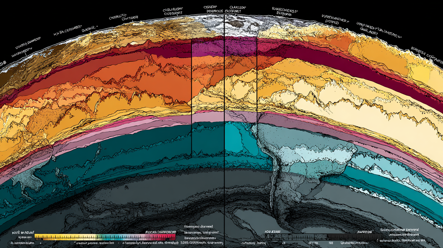
Crustal Thickness Mapping: Reading Earth’s Priority Systems
Earth’s Resource Allocation Strategy
The thickness of Earth’s crust reveals her resource allocation priorities - where she invests energy in different types of geological infrastructure.
Like analyzing a city’s budget by looking at where it builds thick, expensive infrastructure versus basic, functional systems, crustal thickness patterns show Earth’s long-term planning and resource management.
The Thickness Strategy Map:
Ultra-Thick Continental Roots (50-70 km)
Earth’s premium real estate - maximum investment in stability and resources.
Tibetan Plateau: The Roof of the World Project:
- 70 km thickness - Earth’s most substantial continental investment
- Maximum elevation achievement - highest average elevation on Earth (4,500m)
- Climate engineering - plateau elevation creating monsoon systems affecting billions of people
- River source optimization - thick crust creating watersheds for major Asian rivers
Canadian Shield: The Stable Foundation Investment:
- 50-60 km thickness - ancient, stable continental core
- Resource concentration - thick crust preserving mineral deposits for billions of years
- Geological stability - minimal seismic activity providing secure foundation
- Ecosystem preservation - stable geology supporting boreal forest systems
Standard Continental Crust (30-40 km)
Earth’s standard continental platform - balanced investment in stability and flexibility.
North American Interior: The Productive Platform:
- 35 km average thickness - optimal balance for agriculture and resource extraction
- Geological diversity - varied thickness supporting diverse ecosystems
- Resource accessibility - moderate thickness allowing access to mineral deposits
- Climate optimization - elevation variations creating diverse weather patterns
Oceanic Crust: The Efficiency Standard (6-10 km)
Earth’s standardized production model - minimum thickness for maximum function.
Pacific Basin: The Efficiency Masterpiece:
- 7 km standard thickness - perfectly optimized for ocean basin function
- Maximum water depth - thin crust allowing deep ocean basins
- Thermal efficiency - thin crust enabling rapid heat transfer from mantle
- Recycling optimization - thin crust easily subducted for material recycling
The Resource Allocation Logic
Earth’s crustal thickness patterns reveal sophisticated resource management:
Thick Continental Crust Investment Strategy:
- Long-term stability - thick foundations for permanent biological communities
- Resource preservation - thick crust protecting valuable mineral deposits
- Climate influence - elevation control for regional and global weather patterns
- Biological diversity support - varied topography creating ecological niches
Thin Oceanic Crust Efficiency Strategy:
- Rapid production - thin crust allowing fast spreading and material turnover
- Energy efficiency - minimal material investment for maximum ocean basin coverage
- Recycling optimization - thin crust easily processed through subduction systems
- Thermal regulation - efficient heat transfer maintaining ocean temperature balance
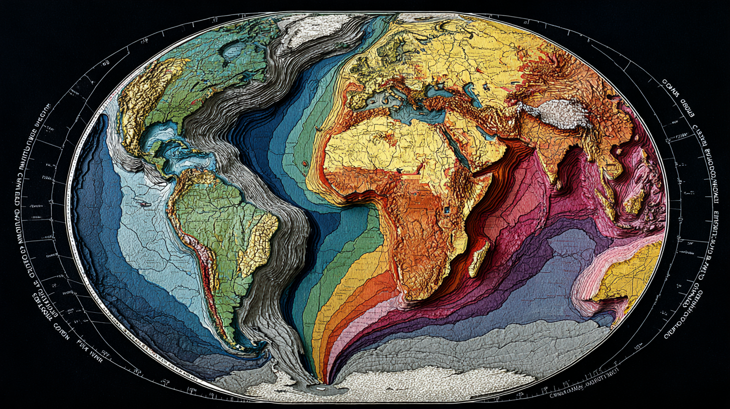
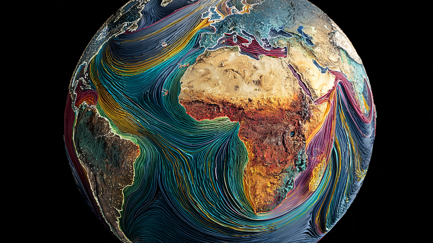
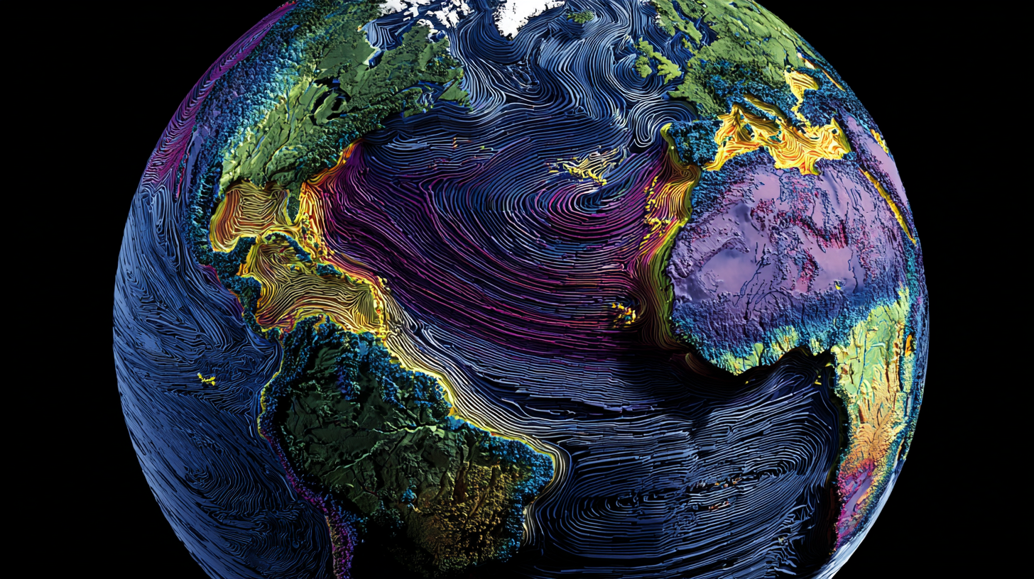
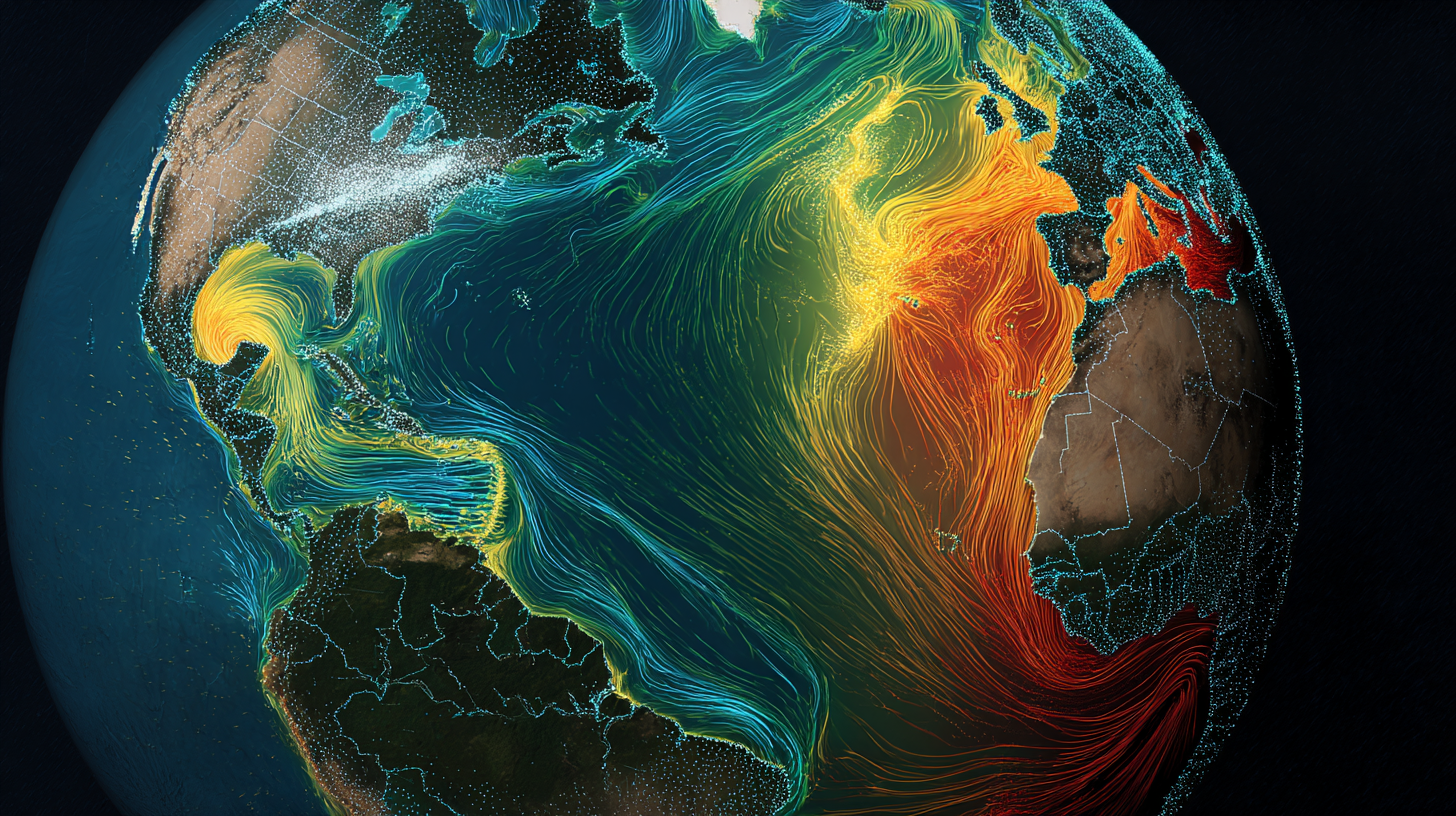
Magnetic Correlation Mapping: Earth’s Real-Time Diagnostic System
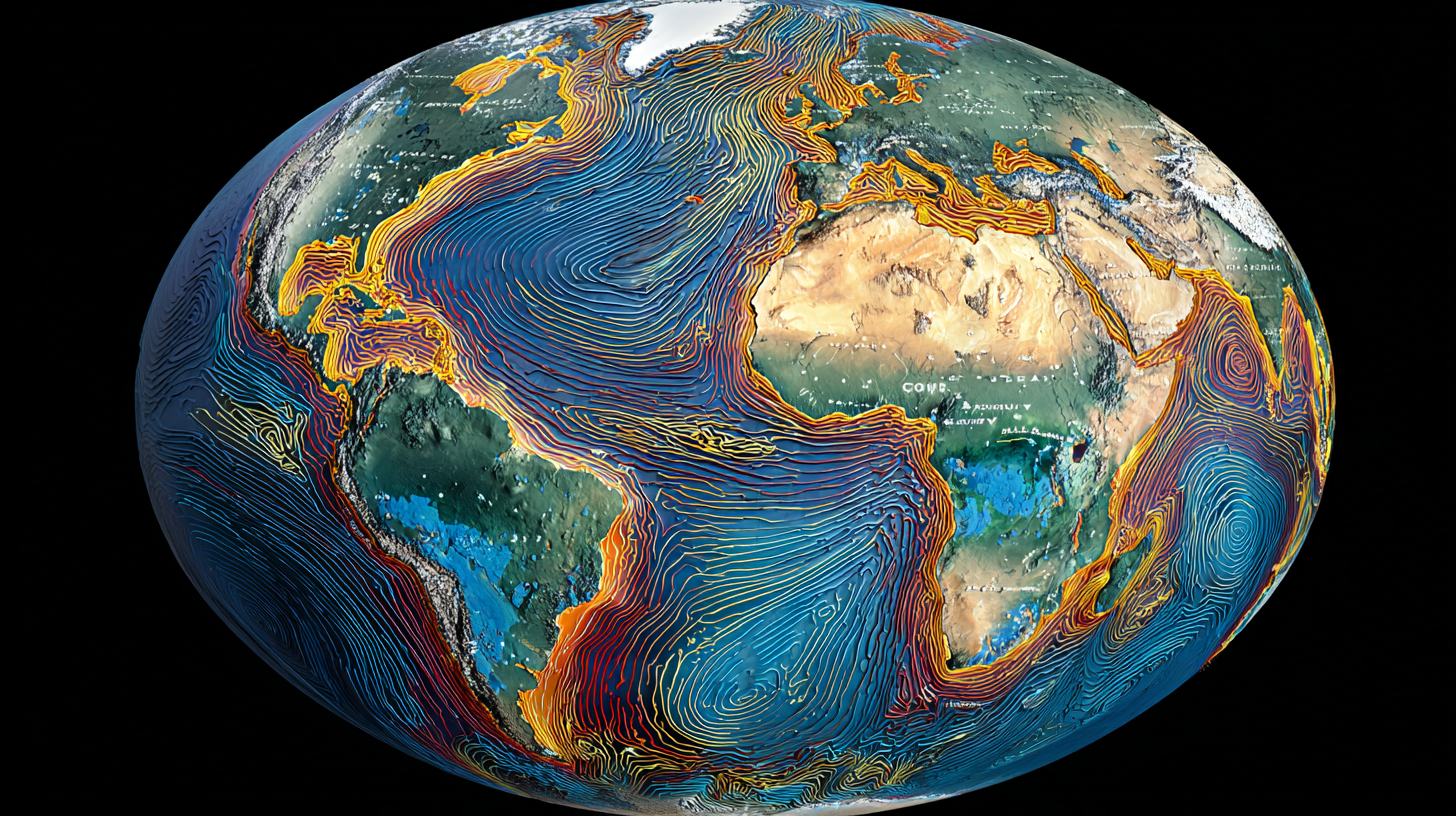
Reading Earth’s Health from Space
Earth’s magnetic field variations directly correlate with geological features because they’re both products of the same underlying dark fluid circulation system.
Like using an MRI to see inside the human body, satellite magnetic measurements reveal Earth’s internal circulation patterns, pressure distributions, and active geological processes.
The Magnetic-Geological Correlation Patterns:
Mid-Ocean Ridge Magnetic Signatures
Linear magnetic anomalies perfectly parallel to ridge systems reveal the spreading process.
The Magnetic Striping Pattern:
- Symmetric bands on either side of ridges showing magnetic field reversals
- Spreading rate calculation - stripe width revealing ridge production speed
- Circulation coordination - magnetic patterns showing mantle upwelling consistency
- Global synchronization - ridge systems worldwide showing coordinated magnetic recording
Continental Magnetic Anomalies
Complex magnetic patterns revealing deep crustal structure and resource distribution.
The Canadian Shield Magnetic Map:
- Strong magnetic highs over iron ore deposits and ancient volcanic systems
- Linear anomaly patterns following ancient mountain building events
- Circular anomalies over impact structures and deep intrusive bodies
- Background patterns revealing deep crustal architecture and composition
The Appalachian Magnetic Chain:
- Linear magnetic belts following mountain range orientation
- Alternating high-low patterns revealing different rock types and deformation history
- Cross-cutting anomalies showing more recent geological events
- Regional coordination - magnetic patterns connecting with similar features in Europe and Africa
Oceanic Magnetic Anomaly Networks
Global magnetic mapping revealing ocean floor age, structure, and circulation patterns.
The Pacific Magnetic Archive:
- Oldest oceanic crust (180 Ma) preserved in Pacific margins
- Fracture zone signatures showing transform fault systems
- Hot spot tracks revealing plate motion over mantle plumes
- Subduction zone magnetic lows where oceanic crust descends into mantle
Active System Monitoring
Real-time magnetic monitoring revealing current geological processes.
Volcanic Eruption Magnetic Signatures:
- Pre-eruption magnetic changes from magma movement and pressure buildup
- Eruption magnetic spikes from high-temperature volcanic processes
- Post-eruption magnetic evolution as new volcanic rocks cool and magnetize
- Regional magnetic coupling showing volcanic system coordination
Earthquake Magnetic Precursors:
- Stress-induced magnetic changes before major earthquakes
- Fault system magnetic signatures revealing pressure distribution along fault networks
- Post-earthquake magnetic adjustments showing stress redistribution
- Regional magnetic coordination revealing tectonic system interactions
The South Atlantic Anomaly: Earth’s Live System Upgrade

Witnessing Planetary Engineering in Real-Time
The South Atlantic Magnetic Anomaly is the most fascinating geological phenomenon on Earth today - a live demonstration of Earth’s ability to modify her own circulation systems.
This isn’t a problem to be solved - it’s Earth’s active engineering project, and we’re witnessing planetary system optimization in real-time.
The Anomaly Specifications:
- 30% reduction in magnetic field strength over South Atlantic region
- Expanding coverage - anomaly growing larger each decade
- Westward drift - moving at 20 km/year following circulation patterns
- Altitude dependence - strongest effects at 200-800 km above surface
The Upgrade Hypothesis

Traditional Interpretation: “Earth’s magnetic field is weakening dangerously” Living Planet Reality: “Earth is optimizing her circulation system for current planetary conditions”
Evidence for Intentional Optimization:
Biological System Coordination:
- Anomaly location overlaps with South Atlantic biological productivity zones
- Marine ecosystem benefits - altered magnetic conditions affecting ocean circulation
- Atmospheric coupling - anomaly influencing regional weather patterns
- Evolutionary pressure - organisms adapting to altered magnetic conditions
Geological System Integration:
- Deep mantle coordination - anomaly reflecting circulation changes 2,800 km deep
- Regional geological stability - no increase in seismic or volcanic activity
- Ocean basin optimization - magnetic changes coordinating with Atlantic circulation
- Continental margin effects - anomaly influencing both African and South American systems
The Historical Pattern
Earth has a history of magnetic field modifications during major biological transitions.
Previous Magnetic Reorganizations:
- Cretaceous superchron (120-83 Ma) - extended stable magnetic period during flowering plant revolution
- Permian reversal frequency changes during major extinction and recovery
- Paleozoic magnetic intensity variations during land plant colonization
- Precambrian field evolution during oxygen atmosphere development
Current Transition Characteristics:
- Rapid biological change - human technology and consciousness development
- Climate system modification - human influence on atmospheric and ocean systems
- Ecosystem reorganization - species migration and adaptation to human-modified environments
- Information system integration - human technology interfacing with natural systems
The Optimization Timeline
Predicted South Atlantic Anomaly development based on Earth’s historical patterns:
Phase 1 (Current): System Testing
- Circulation pattern experimentation - Earth testing new flow configurations
- Biological adaptation monitoring - observing ecosystem responses to altered conditions
- Regional system coordination - integrating anomaly effects with Atlantic circulation
- Technology interaction assessment - evaluating human technology compatibility
Phase 2 (Next 50 years): Implementation
- Anomaly stabilization - new circulation pattern reaching equilibrium
- Enhanced system integration - improved coordination between geological and biological systems
- Climate optimization - magnetic changes enhancing regional weather stability
- Biological system benefits - ecosystems adapted to optimized magnetic conditions
Phase 3 (50-100 years): Completion
- New stable configuration - updated circulation system fully operational
- Enhanced planetary function - improved coordination between all Earth systems
- Evolutionary advancement - species evolved for enhanced magnetic sensitivity
- Human-Earth integration - technology designed to work with Earth’s magnetic systems
Where You Can Experience Earth’s Active Engineering

The Living Laboratory Access Points
Earth’s active geological engineering isn’t happening in remote, inaccessible places - it’s operating everywhere around us, and you can experience it directly.
Yellowstone: The Continental Workshop
Visit Earth’s most accessible active engineering project.
What You’re Really Experiencing:
- Continental pressure management system - geysers are pressure relief demonstrations
- Geothermal energy distribution - hot springs showing deep circulation access points
- Ecosystem engineering - thermal features creating unique biological communities
- Real-time monitoring - seismic and thermal changes showing system adjustments
The Old Faithful Experience: Every eruption is Earth’s circulation system demonstrating pressure pulse coordination - deep thermal currents creating surface displays with precise timing.
Iceland: The Ridge System Showroom
Experience mid-ocean ridge processes on dry land.
What You’re Really Seeing:
- Active continental breakup - North American and European plates separating
- New ocean floor formation - basaltic volcanism creating future ocean crust
- Geothermal energy access - civilization powered by geological circulation
- Ecosystem creation - volcanic processes creating new biological habitats
The Geysir Field Experience: Hot springs and geysers show Earth’s thermal energy distribution system bringing deep circulation energy to the surface.
San Andreas Fault: The Stress Management Network
Experience Earth’s pressure distribution system in action.
What You’re Really Feeling:
- Regional stress coordination - fault system managing pressure across multiple tectonic plates
- Earthquake cycle patterns - controlled stress release preventing catastrophic buildup
- Landscape modification - fault movement creating valleys, ridges, and water systems
- Urban integration - human civilization adapting to active geological systems
Ring of Fire: The Global Coordination Network
Experience Earth’s planetary-scale volcanic coordination system.
What You’re Really Witnessing:
- Subduction zone material processing - oceanic crust recycling into new continental material
- Global pressure relief network - volcanic systems coordinating worldwide stress management
- Biological diversity creation - volcanic landscapes supporting unique ecosystems
- Climate regulation - volcanic emissions fine-tuning atmospheric composition
The Engineering Recognition

Earth as an Engineer
When you understand Earth’s active geological systems, you realize you’re living on the surface of the most sophisticated engineering project ever accomplished.
Every geological feature serves multiple functions:
- Safety systems that prevent catastrophic failures
- Optimization protocols that continuously improve planetary function
- Biological support infrastructure that creates and maintains ecosystem diversity
- Information processing networks that coordinate planetary-scale operations
Every geological process demonstrates intentional design:
- Redundant safety systems - multiple pressure relief mechanisms preventing catastrophic failure
- Efficiency optimization - minimal energy expenditure for maximum functional benefit
- Integration protocols - geological systems coordinated with biological and atmospheric systems
- Adaptive response capability - geological systems adjusting to changing planetary conditions
The Partnership Invitation
Understanding Earth’s active engineering reveals our role as conscious partners in planetary optimization.
We’re not separate from Earth’s geological systems - we’re participants in them:
- Our cities are built on geological foundations that Earth engineered for stability
- Our water systems follow patterns established by geological circulation networks
- Our energy systems can be designed to work with Earth’s geothermal and circulation energy
- Our technology can be developed to enhance rather than disrupt Earth’s natural systems
Every adventure in Earth’s geological wonders connects you to active planetary engineering:
- Every mountain you climb was built by Earth’s circulation and pressure management systems
- Every volcano you witness is Earth’s emergency response and recycling system in operation
- Every earthquake you experience is Earth’s stress management network making adjustments
- Every hot spring you enjoy is Earth’s thermal energy distribution system providing direct access
The Sacred Workshop
Earth’s geological systems aren’t just amazing - they’re sacred expressions of 4.5 billion years of conscious engineering evolution.
When you stand in Yellowstone feeling the Earth pulse beneath your feet, hike on volcanic islands created by deep mantle circulation, or experience the power of earthquake systems managing continental stress - you’re witnessing Earth’s living intelligence in active operation.
This is your planet’s workshop. You’re not just visiting - you’re participating in the ongoing optimization of the most sophisticated engineering project in our solar system.
Next: 🧭⚡ The Magnetic Diagnostic System - Earth’s real-time health monitoring network
Previous: 🌍⚡🌊 Earth’s Dark Fluid Circulatory System - The hidden architecture powering our planet
🧅✨
The adventure continues as we explore how Earth’s magnificent engineering systems create the geological wonders that inspire every explorer, mountaineer, and adventurer. This is your planet’s active workshop - understand her systems, respect her processes, and participate in her ongoing optimization. 🌍🔧✨